Includes latitude and longitude for each UPRN
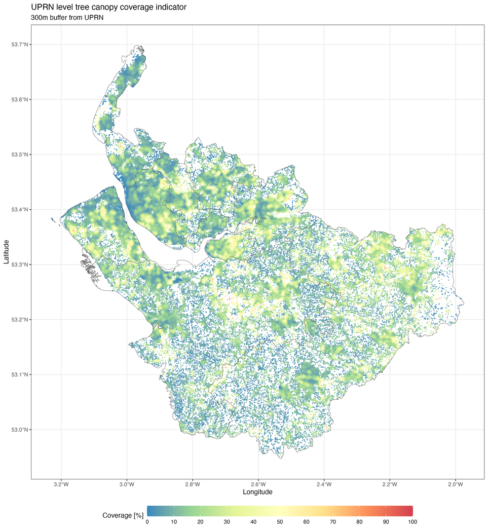
This is an indicator with the tree canopy coverage for various distances (15m, 25m, 150m, 300m and 500m) from Unique Property Refence Numbers (UPRNs) in the Office for National Statistics (ONS) UPRN directory v2024.07 (Epoch 111). This metric is based on Bluesky’s National Tree Map™, which is the only tree dataset to include trees in Great Britain and the Republic of Ireland that are 3 metres and taller.
Available files
- UPRN_3_1_tree_canopy_coverage_cm_with_coords.csv: covers the Cheshire and Merseyside region (England) and includes latitude and longitude for each UPRN.
- UPRN_3_1_tree_canopy_coverage_cm.csv: covers the Cheshire and Merseyside region (England).
- UPRN_3_1_tree_canopy_coverage_lothian_with_coords.csv: covers the Lothian region (Scotland) and includes latitude and longitude for each UPRN.
- UPRN_3_1_tree_canopy_coverage_lothian.csv: covers the Cheshire and Merseyside region (England).
Tree canopy coverage for Cheshire & Merseyside - 300m buffer from UPRNs (v2.00)
Tree canopy coverage for Lothian - 300m buffer from UPRNs (v2.00)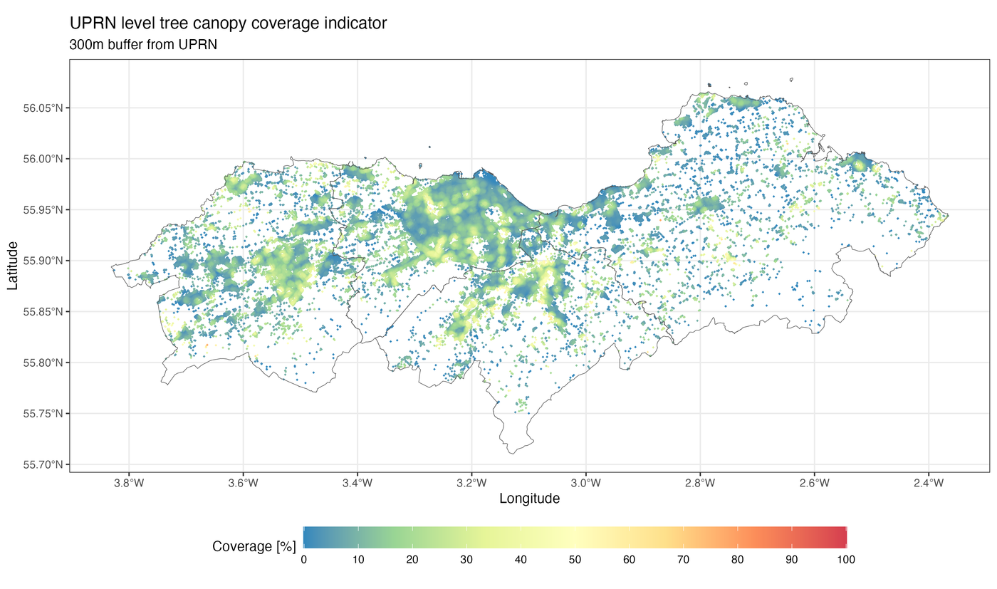
7 files

Tree canopy coverage - Cheshire and Merseyside [England][Version v2.00]
Without coordinates information
Tree canopy coverage - Lothian [Scotland][Version v2.00]
Includes latitude and longitude for each UPRN

